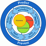
 In recent years geographical information systems have becoming increasingly popular with law enforcement agencies, helping to predict crime hotspots, burglaries, and other incidents
In recent years geographical information systems have becoming increasingly popular with law enforcement agencies, helping to predict crime hotspots, burglaries, and other incidents.
With amateur meth labs popping up across the country and flooding communities with the dangerous drug, researchers at Kansas State University have developed a sophisticated geospatial predictive algorithm that can map out where these hazardous labs are most likely to spring up next.
In a study of Colorado Springs, Colorado, Max Lu, a geography professor at Kansas State, and Jessica Burnum analyzed the spatial patterns of meth labs to understand their distribution and the factors that make a location suitable.
Taking the addresses of seized the labs from 1999 to 2005, Lu and Burnum geocoded the data into a map and developed an algorithm based on several factors including demand for the drug, motivated offenders, and an attractive environment. The two researchers were able to show that meth labs were slowly making their way into more and more middle-class neighborhoods as well as where they might pop up next.
Under the Smart Policing Initiative, police departments across the United States are integrating geospatial predictive analysis into their daily operations. More specifically the Lowell, Massachusetts and New Haven, Connecticut police departments have begun using an algorithm similar to Lu’s to find areas most likely to house drug dealers as well as where car break-ins will occur.